New game invented
So. You've visited every geocache in the area that is available in winter. There are no interesting waymarks nearby, and you lack the determination to go to a degree confluence. What other ways are there to have fun with a GPS receiver?
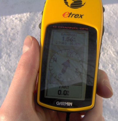 The answer lies in a pair of dice. Or, as we shall soon discover, about 3 to 5 of them. The idea is to pick out a random set of coordinates, and see where they will take you. You could just do it the old-fashioned way by throwing a dart at a map, but who has a map that size, and a dart-proof wall on which to hang it? Besides, part of the fun lies in not knowing where you end up until you get there. Or at least, as close to the spot as possible. The second time I did this, the exact point turned out to be in the middle of a heavily trafficked road. Obviously going all the way to the spot could have some, ahem, adverse health effects.
There are a couple of challenges involved in rolling geographical coordinates with dice. First, obviously you can't roll the DGS coordinate set in its entirety, unless you are prepared to go on a circumnavigation. (Well, maybe you do want to find out where in the world you are going to spend the next holiday. But for me, who just wants to go for a walk for a few kilometers, it's absurd to include the whole world in the probability space.) So you have to limit the set of possible locations somehow.
My first approach involved keeping degrees and minutes the same, and rolling seconds and tenths of seconds, 3 x 2 digits in all. Use a d6 for the first digit (interpreting 6 as 0), and a d10 for the two last one. It is also possible to use a d10 for all digits, but then you have to re-roll if you get a value above 6 for the first digit. That gets tedious after a while.
The problem with the above is that if you don't find yourself smack in the middle of the degree-minute square, you're more likely to walk in one direction than in another. The walking distance will also be skewed. The solution to this is to not roll actual coordinates, but the distance and direction from your current position — sort of a polar coordinate system with you in the origo. The distance part of this is the easiest part. It depends on how long you are willing to put up with walking. I used a d10 to roll the number of tenths of kilometers (the lowest resolution my GPS receiver accepts for making one waypoint the offset of another), and the value of a d4 modulo 2 for deciding whether or not to add an extra kilometer, making the maximal distance 1.9 km. You can also add several dice with the same number of sides to get a binomial distribution centered on half the maximal value.
Now here comes the tricky part: direction. (The denizens of #tut will now understand why I have been pestering them about how to ensure linear distibution while rolling the values from 1 to 360.) You can't roll it digit by digit, because if you roll 0 to 3 with, say, a d4 (subtracting one from the value), each of the digits will be equally likely, when in fact 3 has only a 61 in 360 chance of occurring, while 0 has 99 in 360, and 1 and 2 both have 100 in 360.
What I did was to use two d6 and one d10. First, take the value of the first d6, counting 6 as 0, and multiply it by 60. Then, take the value of the second d6, again counting 6 as 0, and multiply it by ten. Finally, take the value of the d10, counting 0 as 10, and sum the final values of all the dice. This gives a result from 1 to 360 that is linearly distributed.
[Saturday, Mar 25, 2006 @ 18:14] | [miscellaneous] | # | G

